Jilli Chumli Khola is one of the perennial tributaries of Tila River & minor tributaries of Karnali River in karnali river Basin. Several tributaries contribute flows in Jilli Chumli Khola. Catchment area of Jilli Chumli Khola at proposed dam site is about 50.65 sq.km.
Altitude in this basin varies from 120 amsl to 7742 amsl. Catchment area of the project is covered with forest and snow. Drainage basin of this river lies within the higher to middle mountain range. River basin has 20% of area above 5000m and 6% area below 3,000 m. Location of intake site is selected at area having comparatively mild river gradient and the powerhouse site at safe level from high flood of Jilli-Chumli River. Topography is generally favourable for implementation of hydropower project. The powerhouse is at confluence of Ruru Banchu khola and Jilli Khola near Padamghat at 1480 m amsl.
Generated energy will be evacuated to INPS by 132kV Double circuit transmission line at Phukot substation of NEA at Kalikot District. Length of 132 kV transmission line will be about 16 km from project powerhouse to Phukot Substation.
Dam Site and Reservoir Area
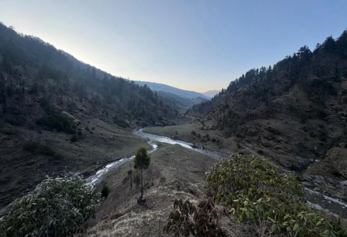
The proposed dam site is situated approximately 100 meters downstream from the confluence of the Jilli Khola and Chumli Khola. This location has been identified as geologically and topographically favorable for dam construction. The river section at this point is narrow, with both the left and right bank hill slopes exposing stable rock outcrops composed predominantly of Gneiss. These rock masses exhibit good strength and continuity, providing a solid and reliable foundation for dam structures, thereby minimizing geological risks.
The proposed reservoir area upstream of the dam site is highly suitable and favorable for the development of a storage-type hydropower project. The river in this region has a gentle gradient and flows through a broad valley, which significantly enhances the storage potential. The combination of a low longitudinal slope of the riverbed and the wide cross-sectional area of the valley allows for a substantial volume of water to be impounded with relatively moderate dam height. This makes the site ideal for achieving high storage capacity, which is crucial for seasonal flow regulation and year-round power generation.
The selected dam and reservoir site offers excellent natural conditions for a storage hydropower project, with favorable geological settings and topographic features that contribute to technical feasibility and long-term operational reliability.